
Logan Gall
Spatial Data Scientist
Minneapolis, MN
Get to Know Me
My name is Logan Gall, I am a tech enthusiast and dedicated problem solver. While studying Data Science as an undergraduate at the University of Minnesota, I became increasingly interested in geospatial data, which guided my decision to pursue a GIS master's degree. In the fall of 2025, I started teaching at the University of Minnesota, where I am developing content and curriculum for spatial data science teaching & outreach. I’ve had the opportunity to work on many projects utilizing spatial data science, machine learning, sensors, and computational hardware that bring out my passion for applied innovative technology. I always get a rush of excitement discussing complex problems, teaching new things, and fostering more connections throughout my career!
Projects
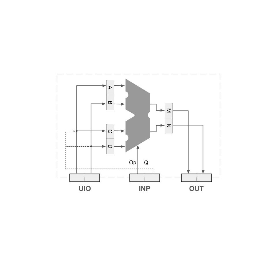
Spatial Processing Unit
Developed a customized hardware chip designed to perform hardware-accelerated spatial data processing and operations.
Read More
Drone-based Wireless Control Link
Read More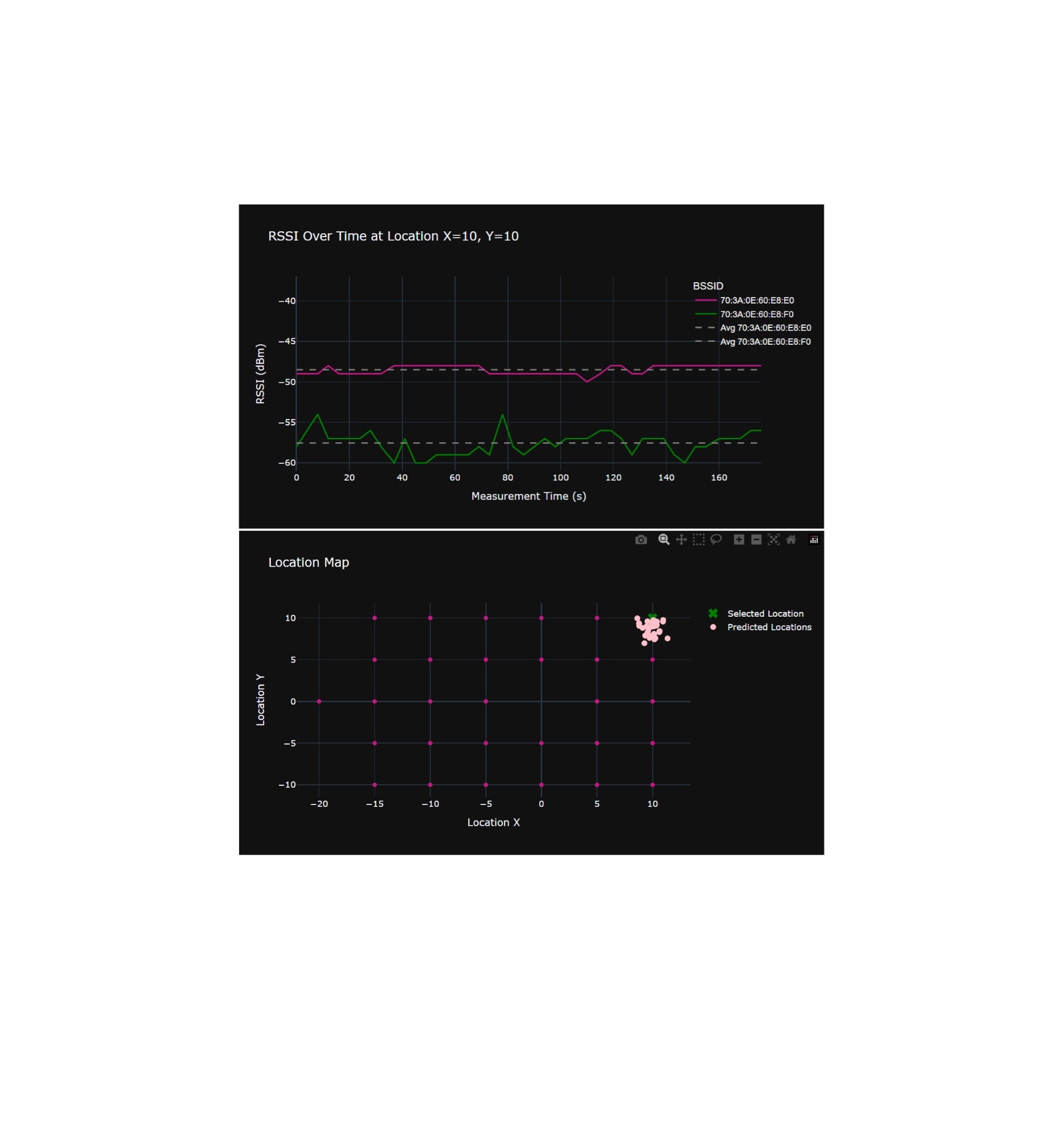
Indoor Location Estimation
Analyzed the efficacy of using WiFi access point signals and machine learning to perform localization in an indoor environment.
Read More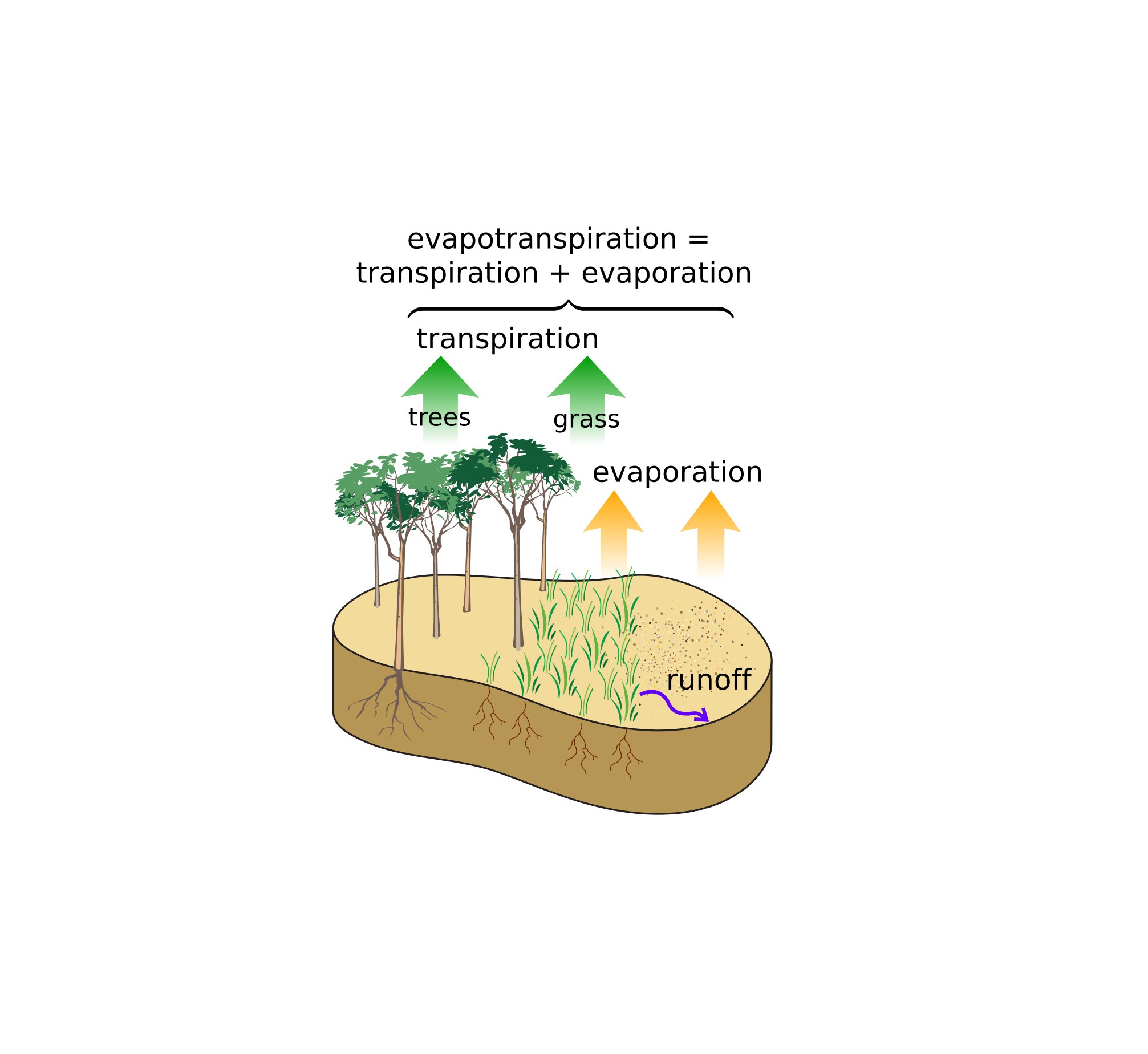
Evapotranspiration Deep Learning & Modeling
Read More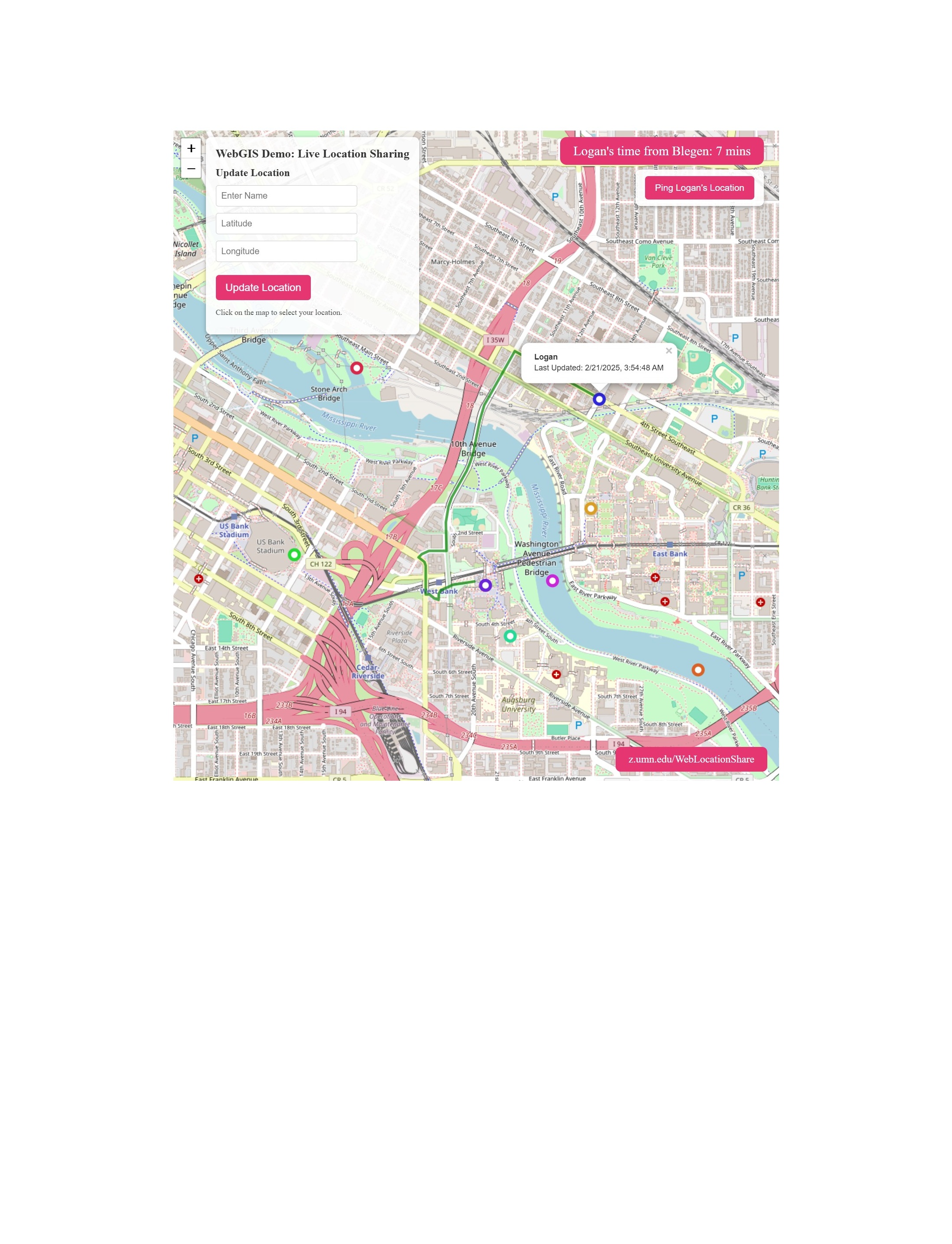
Cloud-Driven Live Location Sharing
Created a location sharing applicaiton designed for live updates between colleagues & friends at major events, hosted using Google Cloud SQL, Build, and Run services.
Read More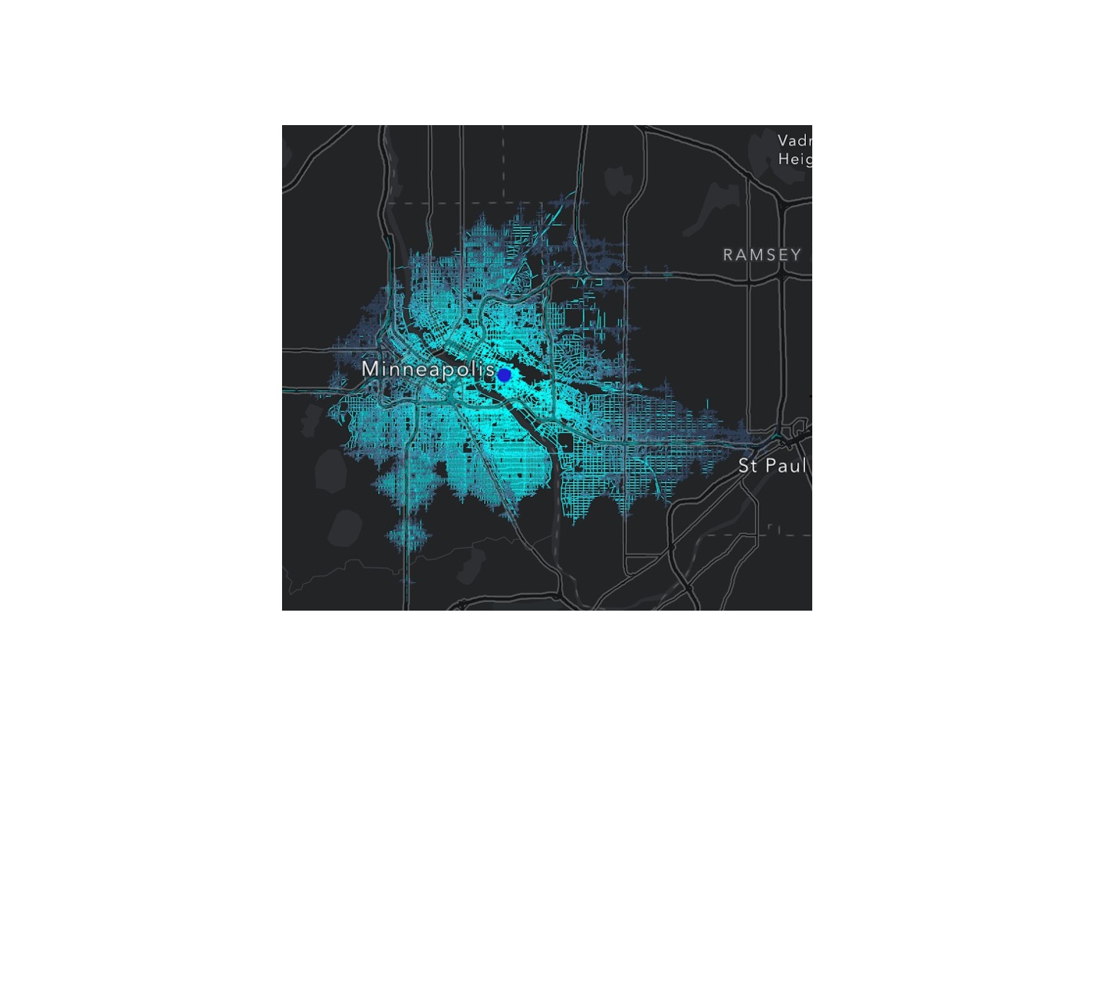
Traffic Impact Prediction Modelling
Read More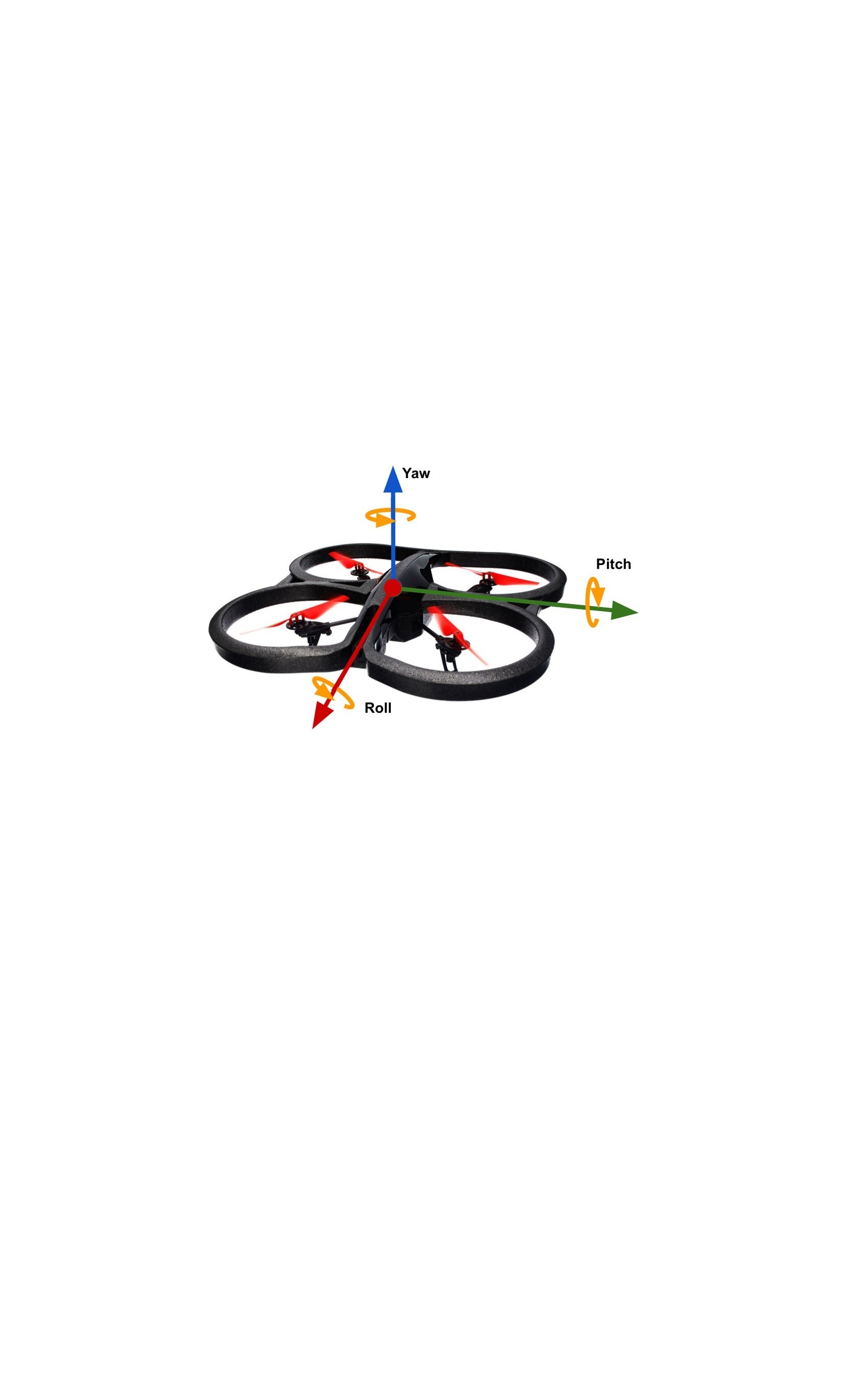
Motion-Based Drone Controller
Read MoreResume
Download ResumeEducation
Masters of Geographic Information Sciences May 2025
University of Minnesota Minneapolis, MN
- GPA: 4.0
- Activities: GIS Student Organization (GISSO) President, Copter Club (Drone Club) President
- Relevant Coursework: Advanced Geocomputing, Spatial Database Design, Spatial Data Science II, Digital Signal Processing Design, Spatiotemporal Modeling & Simulation, WebGIS & Services
B.S. Data Science, Statistics Minor Sept. 2019 - May 2023
University of Minnesota Minneapolis, MN
- GPA: 3.78, Dean's List: 4 terms
- Activities: Copter Club (Drone Club) President, Campus Car Club Vice President, Association for Computing Machinery Member
- Relevant Coursework: Analytics and Data Driven Decision Making, Machine Learning Fundamentals, Mathematics of Image and Data Analysis, Operations Research for Data Science, Theory of Statistics
Work Experience
Graduate Research Assistant Jan. 2025 - Present
University of Minnesota, Department of Geography, Environment, and Society Minneapolis, MN
- Began design and development of computational hardware chips for spatial processing operations
- Performed data engineering, solved inquiries, and presented research findings at industry conference events
- Supported the University of Minnesota’s GeoCommons research, teaching, and engagement activities
Graduate Research Assistant Aug. 2023 - Jan. 2025
University of Minnesota, GEMS Informatics St. Paul, MN
- Created machine learning models for spatiotemporal evapotranspiration prediction
- Designed workflow methods for cloud-centric programming and data sharing
- Worked on grants, proposals, and papers for irrigation-based agricultural research
- Designed and implemented data cleaning, preparation, and analysis methodologies
Internet Safety Evaluator Apr. 2020 - Aug. 2023
TELUS International AI Las Vegas, NV
- Trained AI to analyze social media posts by evaluating the accuracy of videos and comments
- Assessed content source trustworthiness to enhance automatic safety flagging systems
R&D Data Science Intern May 2022 - Aug. 2022
The TORO Company Bloomington, MN
- Created a machine learning model-based program for sports field management
- Performed drone flights for analysis of field conditions during tournament play
- Executed a research study of sports field treatments and their effects on field quality
- Implemented data cleaning, modeling, and treatment recommendation programs for field management
Certifications, Publications, and Skills
- Certifications: FAA Part 107 (Professional Drone & UAS Operations)
- Publications: Gall, L., Glancy, T., Kantar, M., & Runck, B. C. (2024). A tool for integrating agrometeorological observation data for digital agriculture: A Minnesota case study. Agricultural and Environmental Letters, 16 October 2024. https://doi.org/10.1002/ael2.20147.
- Data Science: Cloud Computing, Data Cleaning, Data Engineering, Geospatial Modeling, Machine Learning, Statistics
- Hardware: Drones, IoT Sensors, Microcontroller programming (Arduino, ESP-32, Raspberry Pi), Wireless Protocols
- Programming: C++, CSS, HTML, JavaScript, Julia, Python, R, SQL, Verilog
- Python Libraries: Flask, Folium, MatPlotLib, Numpy, Pandas, Psycopg, PyTorch, SciPy, Tensorflow Keras
- Tools & Platforms: ArcGIS Pro, Docker, GitHub, Google Cloud Run, Jupyter Notebooks, Unity, Vivado